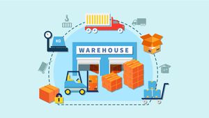
Geofencing in transport management refers to the use of GPS and cellular data to create virtual boundaries called geofences around physical locations such as warehouses, delivery points, toll plazas, and approved route corridors. When a vehicle crosses these boundaries, the system automatically triggers predefined actions: logging an arrival, sending an alert, recalculating an ETA, or escalating an exception to the operations team. Unlike basic GPS tracking, which only shows where a vehicle is, geofencing defines where a vehicle should be and flags the moment that expectation is violated.
For most transport operators, delivery delays are not caused by a massive system failure. Instead, they keep piling up from minor, unnoticeable deviations that compound silently - missed departure schedules, unauthorized stoppages, route deviations, skipped dock windows, etc.
The real issue isn’t in knowing that delays occurred - it’s in not knowing the initiation point, root cause of the delay, and if it could have been stopped early on. This is the exact juncture at which the geofencing feature in Fleetx’s transporter management system comes into the picture. It pauses being a “tracking attribute” and becomes a layer for controlling the execution process. It isn’t used for placing location pings on a map; it enforces discipline across trip execution - more so in high-volume, SLA-centric sectors such as FMCG, cold chain, manufacturing, e-commerce, and others.
What Does Geofencing Represent Within the Fleetx TMS Ecosystem
On the Fleetx platform, geofencing is not a standalone feature but is deeply embedded within the trip workflows, ETA rationale, SLA metrics, and exception management. The core feature creates a virtual operational limit around several geographic points:
Warehouse, plants, and distribution centers
Customer delivery site
Toll plaza, hubs, and factory yards
Approved routes
No-halt and restricted areas
Its real value is in how Fleetx responds when the boundaries are crossed.
Truck reaches customer geofence: arrival is auto-logged
Vehicle stops outside an approved area: ops team gets a real-time alert
Risk of delay detected mid-trip: auto-ETA recalculation
GPS tracking vs geofencing: what is the difference?
Many transport operators confuse GPS tracking with geofencing — or treat geofencing as a minor upgrade to tracking. In practice, they solve fundamentally different problems.
Capability
Basic GPS tracking
Geofencing in TMS
Primary function
Shows vehicle location on a map
Enforces operational boundaries and triggers automated actions
Delay detection
Identified after the fact
Detected in real time as deviation occurs
Arrival logging
Manual entry by driver or ops team
Auto-logged on geofence entry
Unauthorized stoppages
Reviewed in post-trip audit only
Instant alert with automatic duration tracking
ETA updates
Communicated manually via phone or WhatsApp
Auto-recalculated and pushed to all stakeholders
SLA compliance
Tracked retrospectively
Monitored continuously with live exception flags
ePOD triggering
Not supported
Auto-triggered on destination geofence exit
Why Delivery Delays Continue - Even With Varying Degrees of “TMS” Control
Nearly all transport operators use some form of truck transport management system or software, and yet recurring delays are an everyday reality - most systems still operate reactively - giving rise to the following ground realities:
Variable route performance every day on the same course
Drivers use personal route knowledge, not system-navigated paths
Phone calls and WhatsApp are still being used for ETA updates
Dock congestion is identified after an SLA breach
Unauthorized stoppages are detected only as post-trip audit findings
In the absence of real-time transporter monitoring, deviations remain hidden till it’s too late. A basic TMS reports delays, but the geofencing from Fleetx is capable of preventing them.
The scale of the problem: delivery delays in Indian logistics
Delivery delays are not a minor operational inconvenience- they carry measurable financial and reputational costs. According to the Economic Survey 2023-24, logistics costs in India account for approximately 8-9% of GDP, compared to 4-5% in developed economies, with last-mile inefficiencies being a primary contributor. A report by Redseer Strategy Consultants (2023) found that over 35% of B2B shipments in India experience at least one transit delay per month, with urban congestion and dock bottlenecks accounting for nearly half of those incidents.
In high-frequency sectors such as FMCG and e-commerce, an OTIF (On-Time In-Full) miss rate of even 5-8% can result in retailer chargebacks, lost shelf space, and contract penalties. For cold chain shipments, a delay of 2-4 hours in transit can compromise product quality and trigger regulatory non-compliance. These numbers make a compelling case for moving beyond passive tracking toward systems that actively enforce execution discipline- which is precisely the role geofencing plays in a modern transport management system.
How Geofencing On Fleetx Helps Reduce Delivery Delays
Geofencing runs on three firmly integrated layers, not as a patch-on feature:
Location Intelligence Level
Fleetx offers dynamic geofencing for -
Origin and destination updates
Hubs and yards notifications
Route passages and heavy congestion zones
No-halt areas and other sensitive extensions
These can be configured at scale - across thousands of trips, with no manual intervention required for each vehicle.
Event Detection Level
Continuous monitoring is available for -
Timestamps of all entries and exits
Stoppage time inside each geofence
Deviations from assigned routes
Unscheduled halts, contradictory movement, or vehicle idling
These are real-time updates, not trip-audit findings.
Activity and Automation Level
The geofence events enable Fleetx to -
Dynamically update ETAs
Activate alerts and exception workflows
Record SLA milestones automatically
Share actionable insights to ops and control towers
Direct Impact of Fleetx Geofencing on Minimizing Delivery Delays
Thousands of satisfied clients have experienced the benefits of using Fleetx for controlling their shipment delays, and here are the beneficial features that are changing the game:
Locating Route Diversions Early On and ETA Realignment
For Fleetx users, route deviation isn’t logged at trip closure - it’s constantly monitored through the trip tenure. All approved routes are geofenced, enabling the system to detect the moment any truck deviates from the assigned path, triggering an instant alarm to the operations team. This offers a chance to intervene in the scene while there’s still a possibility to prevent any delay. Fleetx reconfigures ETAs dynamically and passes on updated timelines down the chain for supervisors and customers to stay updated. This mid-trip course correction helps cut avoidable delays significantly, and SLA management shifts from damage control to expectation revision. Fewer surprises lead to higher trust and more predictable operations.
Strict Supervision Over Unauthorized Stoppages
Fleetx eliminates such blind spots by considering these as controlled events and not incidental behaviour. Whenever a vehicle stops outside the approved areas, the system raises an instant alert and starts tracking the duration of the halt automatically. Over multiple trips, the system develops a pattern to understand where and why these stoppages occur - if they are frequent on specific routes, tagged with certain drivers, or linked to recurring operational misses. In FMCG and retail networks, this level of control improves OTIF by eliminating execution incompetence from the existing workflows.
Visibility into Dock and Yard Timelines
A big chunk of delivery delays don’t take place on highways at all; they occur in warehouses, plants, and customer locations. Geofencing in logistics enables the same level of transparency in the dock and yard operations that fleets have during transit. Entry and exit times are auto-logged, creating exact wait time records without any manual effort. In case of frequent occurrence, these highlight the patterns to detect a systemic behaviour and not incidental events. The data can be utilized to redesign the process and address any ground-level blockages with evidence and not assumptions.
Improvement in KPIs Driven by the Geofence-Based Fleetx TMS
Fleetx customers consistently experience improvement across several metrics, some of which include -
OTIF (On-Time In-Full): Upward growth
Transit Time Deviation: Downward curve
Unscheduled Stops: Downward curve
Dwell Time at Docks & Yards: Downward curve
Manual Follow-Ups by Ops Team: Downward curve
SLA Dispute Resolution Time: Downward curve
In cold-chain functions, detecting deviations faster reduces the temperature-variation risk by enabling quicker intervention.
On-ground results: geofencing in action across Indian logistics operations
The following case studies are based on outcomes reported by Fleetx customers. Specific metrics are drawn from actual operational data shared by clients. Company names are withheld at client request.
Case study 01
E-commerce logistics operator — Delhi NCR
Background
A Delhi NCR-based e-commerce logistics operator managing a large volume of daily trips across multiple distribution centres was facing persistent ETA inaccuracies and growing SLA disputes with retail partners. The ops team relied on phone calls and WhatsApp for ETA updates, and dock arrival times were being logged manually — creating consistent gaps between reported and actual arrival. Unauthorized stoppages were only surfacing in post-trip audits, with no ability to intervene during a live trip.
What Fleetx geofencing changed
Dock entry and exit times across all distribution centres were auto-logged from day one, eliminating manual timestamp errors
Unauthorized stoppages triggered real-time alerts to the ops team — the same incidents that previously only appeared in next-day audit reports
ETAs were auto-recalculated on deviation and pushed to stakeholders — reducing inbound ETA calls to the ops desk significantly within the first month
ePOD workflows were triggered automatically on destination geofence exit — removing the dependency on driver-initiated proof of delivery
Case study 02
FMCG distributor — Western India
Background
An FMCG distributor operating across a dense urban delivery network in Western India was struggling with high dwell times at retailer stops and inconsistent route adherence. Driver behaviour on last-mile routes was difficult to monitor, and retailer complaints about late or missed deliveries were rising. SLA disputes were frequent, and the ops team had no real-time visibility into where breakdowns in execution were occurring.
What Fleetx geofencing changed
Geofences placed around every retailer stop enabled automatic dwell time tracking — giving ops managers the first clear picture of where time was being lost per route
Route deviation alerts flagged drivers taking alternate roads in real time, allowing supervisors to intervene before the delay compounded across subsequent stops
SLA milestone data — arrival time, dwell duration, departure — was captured automatically at each stop, replacing manual reporting with verified timestamps
OTIF performance improved measurably within the first 45 days, with the ops team shifting from reactive firefighting to proactive exception management
Case study 03
Cold chain logistics provider — Pan-India
Background
A pan-India cold chain logistics provider handling pharmaceutical and perishable food shipments was experiencing temperature excursion events that were often traced back not to equipment failure but to prolonged unauthorized stoppages outside approved cold-storage zones. Vehicles halting at unplanned locations for extended periods caused product quality risk that was only identified after delivery — sometimes triggering regulatory non-compliance. Compliance reporting was manual and lagged by 24–48 hours.
What Fleetx geofencing changed
Any stoppage outside approved cold zones triggered an immediate alert — giving the ops team a window to intervene before a temperature excursion could occur
Geofence event logs replaced manual compliance reporting — every entry, exit, and dwell duration was automatically timestamped and audit-ready in real time
Unauthorized stoppages dropped significantly within the first month as driver behaviour adjusted in response to real-time monitoring and accountability
The combination of geofencing and IoT temperature sensors gave the provider a unified, real-time view of both location compliance and product condition for the first time
Fleetx - Engineering a Successful Merger of Geofencing and AI
The geofence feature enhances visibility, and Fleetx’s AI transport management system turns visibility into insights and optimization. It -
Identifies routes with severe geofence violations
Reports drivers with repeated patterns of delay
Recommends a better dispatch window
Optimizes routes based on real, on-ground data - not static maps
Enterprises evaluating the best software for transport management system are increasingly looking beyond a host of features and, instead, are focusing on decision-enabling intelligence. The advanced Fleetx geofencing - built to enforce process compliance at scale - provides customers with the requisite information on whether the operations are under control or not.
Ensure SLA Compliance - Try Transport Management System Demo from Fleetx
Delivery delays are predictable outcomes of mismanaged deviations. The deeply embedded geofencing in Fleetx TMS ensures deviations don’t stay covered long enough to become SLA violations. For enterprises, medium or large, the messaging is loud and clear - you can’t control delays by reacting swiftly, you minimize them by incorporating systems like Fleetx that supervise execution intently and don’t let any diversion go unnoticed - leaving no room for reactive firefighting, only proactive operations.
Frequently asked questions
Q1
What are the best practices for implementing geofencing in a Transport Management System in India?
The best way to implement geofencing in a Transport Management System (TMS) is by aligning geofence rules with actual operational workflows rather than using static GPS boundaries alone. Indian logistics companies should create geofences around warehouses, customer delivery points, toll plazas, industrial hubs, and restricted halt zones. Real-time alerts for route deviations, unscheduled stoppages, and excessive dwell time help reduce delays and improve SLA compliance. In cities like Delhi, Gurgaon, and Mumbai, where congestion and route unpredictability are common, dynamic ETA recalculation and AI-based route intelligence are becoming critical best practices for transport operators.
Q2
Why are logistics companies in Delhi NCR and Gurgaon increasingly adopting geofencing-based TMS solutions?
Logistics companies in Delhi NCR and Gurgaon are rapidly adopting geofencing-enabled TMS platforms because traditional GPS tracking alone does not provide operational control. High traffic congestion, strict delivery timelines, industrial freight movement, and large warehouse clusters in regions like Manesar, Sohna, Farukhnagar, and Bhiwadi require real-time visibility and automated exception management. Geofencing helps businesses monitor truck movement, detect unauthorized stoppages, automate dock entry and exit logs, and improve fleet discipline. With rising pressure on OTIF performance and customer experience, enterprises are increasingly treating geofencing as a core logistics optimization capability rather than an optional tracking feature.
Q3
Which industries in India benefit the most from geofencing in transport management systems?
Industries with high shipment frequency and strict delivery timelines benefit the most from geofencing-enabled transport management systems. In India, sectors such as FMCG, cold chain logistics, pharmaceuticals, e-commerce, retail distribution, manufacturing, and food & beverage operations are major adopters. Cities like Mumbai, Delhi, Gurgaon, Ahmedabad, and Bengaluru have highly dynamic freight movement patterns where real-time route monitoring becomes essential. Geofencing helps these industries reduce route deviations, monitor turnaround times, improve dock efficiency, and ensure SLA compliance. For cold chain and pharmaceutical logistics specifically, faster deviation detection also helps minimize product spoilage and compliance risks.
Q4
What is the difference between basic GPS tracking and advanced geofencing in logistics operations?
Basic GPS tracking primarily shows the current location of a vehicle, while advanced geofencing acts as an operational control layer within a transport management system. Geofencing creates virtual boundaries around routes, warehouses, customer locations, and operational zones to automate actions based on vehicle movement. For example, it can trigger alerts for unauthorized stoppages, auto-log arrival times, monitor dwell duration, and dynamically update ETAs. Modern Indian logistics companies are moving beyond passive visibility and adopting geofencing because it enables proactive decision-making, reduces manual follow-ups, and improves overall execution discipline across large fleet operations.
Q5
Which are the top features businesses should look for in the best geofencing software for logistics in India?
The best geofencing software for logistics in India should include real-time alerts, route deviation monitoring, dynamic ETA updates, automated SLA tracking, dwell time analytics, and AI-driven exception management. Businesses should also look for scalability, multilingual support, integration with ERP/TMS systems, and accurate monitoring across high-density traffic regions like Mumbai and Delhi NCR. Advanced platforms additionally provide automated ePOD workflows, control tower visibility, driver behavior insights, and predictive delay detection. For enterprises managing large fleets, geofencing software should not only provide tracking visibility but also improve operational efficiency and logistics execution at scale.
Q6
How does geofencing help reduce delivery delays in cities like Mumbai and Delhi?
Delivery delays in cities like Mumbai and Delhi are often caused by congestion, route diversions, dock bottlenecks, and unscheduled stoppages rather than long-distance transit issues alone. Geofencing helps logistics operators detect these disruptions in real time and intervene before delays escalate into SLA violations. By creating operational boundaries around delivery points, warehouses, and approved routes, businesses can monitor actual execution continuously. Automated alerts, ETA recalculations, and dwell-time tracking help operations teams improve response speed and fleet discipline. In highly congested urban logistics environments, geofencing has become essential for maintaining delivery reliability and customer satisfaction.
Q7
Why is AI-powered geofencing becoming important for modern transport management systems?
AI-powered geofencing is becoming important because logistics businesses now require predictive insights instead of reactive tracking. Traditional systems only report delays after they occur, whereas AI-enabled geofencing platforms analyze movement patterns, recurring route deviations, congestion trends, and operational bottlenecks in real time. This helps transport teams identify risk earlier and optimize dispatch planning proactively. In India’s rapidly growing logistics ecosystem, especially across Delhi NCR, Mumbai, Pune, and Bengaluru, enterprises are adopting AI-driven transport management systems to improve ETA accuracy, reduce operational inefficiencies, and gain better control over complex fleet networks and supply chain execution.
Q8
What are the latest logistics and transport management trends related to geofencing in India?
Recent logistics trends in India show increasing adoption of AI-driven geofencing, predictive ETA systems, automated control towers, and real-time transport visibility solutions. Companies are moving away from manual trip monitoring and investing in intelligent transport management platforms that automate exception handling and SLA tracking. Demand is especially rising in major logistics hubs like Delhi NCR, Gurgaon, Mumbai, Chennai, and Hyderabad due to growing e-commerce volumes and tighter delivery expectations. Businesses are also integrating geofencing with IoT sensors, cold chain monitoring, and warehouse systems to create unified, data-driven logistics operations with higher efficiency and visibility.